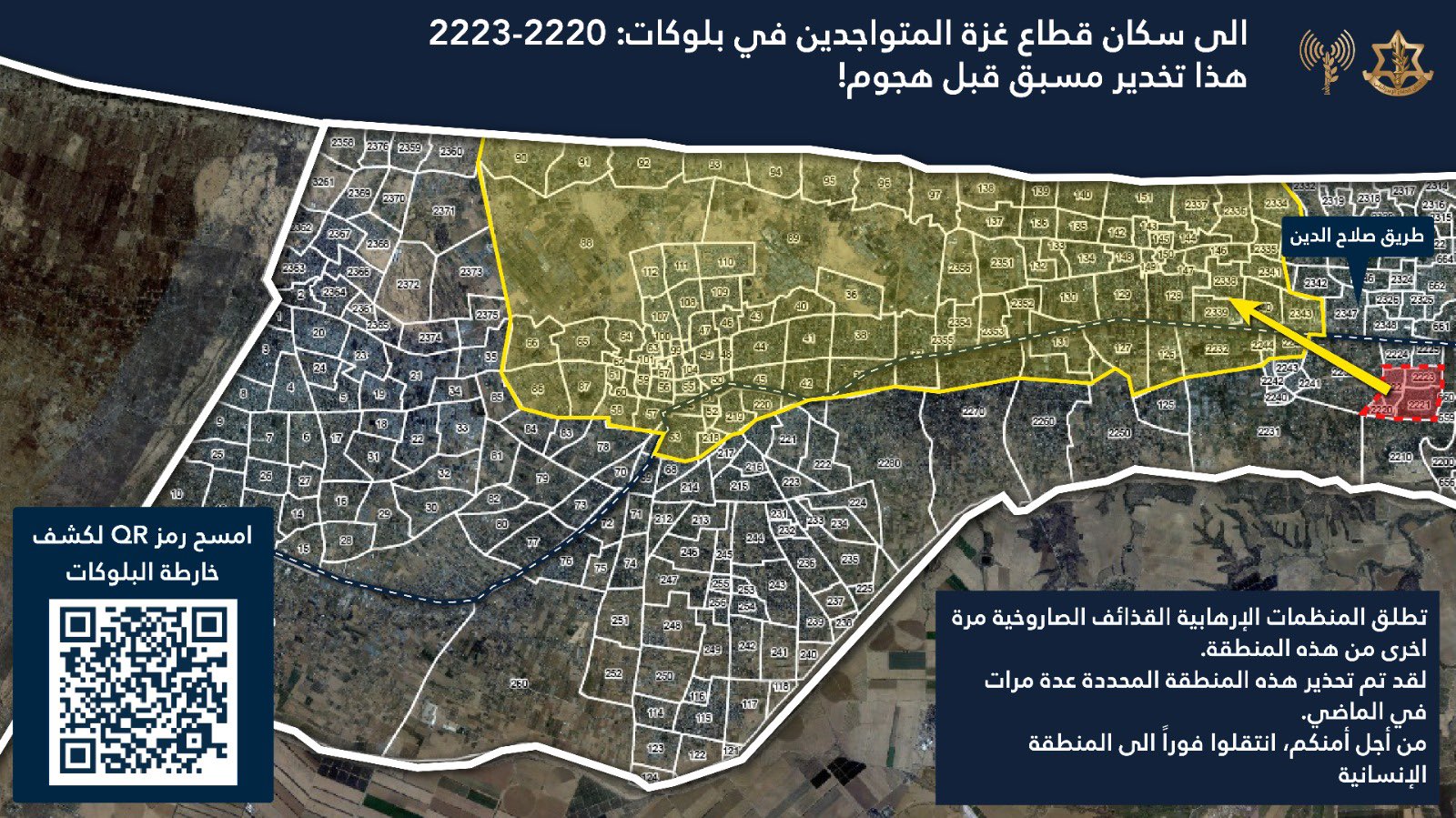
Displacement Order: 1 Jan 2025
Area Impacted
- Ordered displaced: 1.23 sq km
- Labeled "safe": 69.59 sq km
Population Blocks Numbers Ordered Displaced
2220, 2221, 2222, 2223
Population Blocks Labeled "Safe"
36, 37.1, 37.2, 38, 39, 40, 41, 42.1, 42.3, 43, 44, 45, 46, 47, 48, 49, 50, 51, 52, 53, 54, 55, 56, 57, 58, 59, 60, 61, 62, 63, 64, 65, 66, 67, 86, 87, 88, 89.1, 89.2, 90, 91, 92, 93, 94, 95, 96, 97, 99, 100, 101, 102, 103, 104, 105, 106, 107, 108, 109, 110, 111, 112, 126, 127, 128.1, 128.2, 129.1, 129.2, 130.1, 130.2, 131, 132, 133, 134, 135, 136, 137, 138, 139, 140, 142, 143, 144, 145, 146, 147, 148, 149, 150, 151, 218, 219, 220.1, 2232, 2250.1, 2270.1, 2334, 2335, 2336, 2337, 2338, 2339, 2340, 2341, 2351, 2352, 2353, 2354, 2355, 2356
*Any block number ending in a decimal was a previously designated population block that was later split. The decimal indicates a partial block.
Source of IDF Displacement Order
https://x.com/AvichayAdraee/status/1874230679648780348
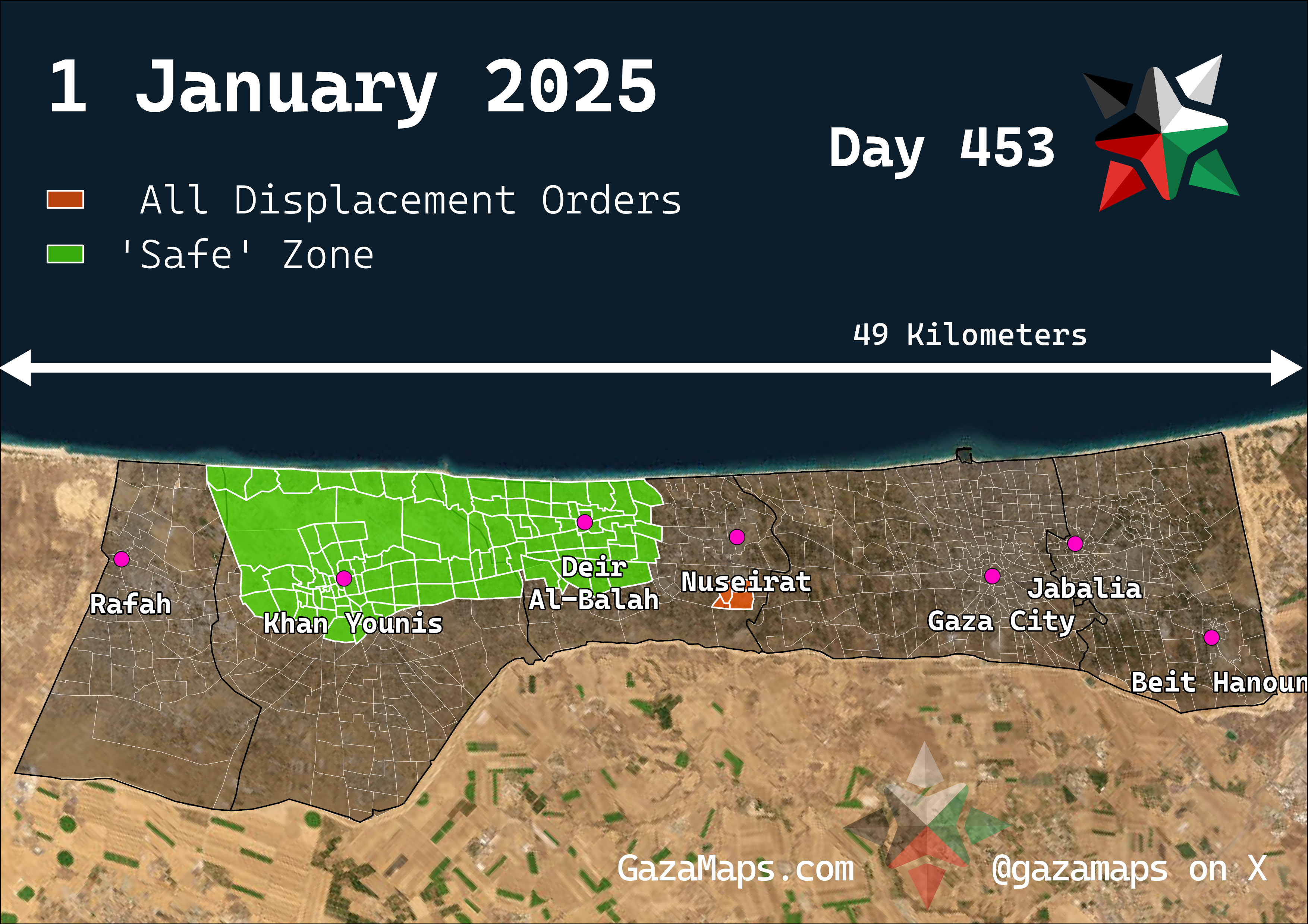
Readable Version, All of Gaza
A readable version of the IDF's forced displacement order, showing all of Gaza
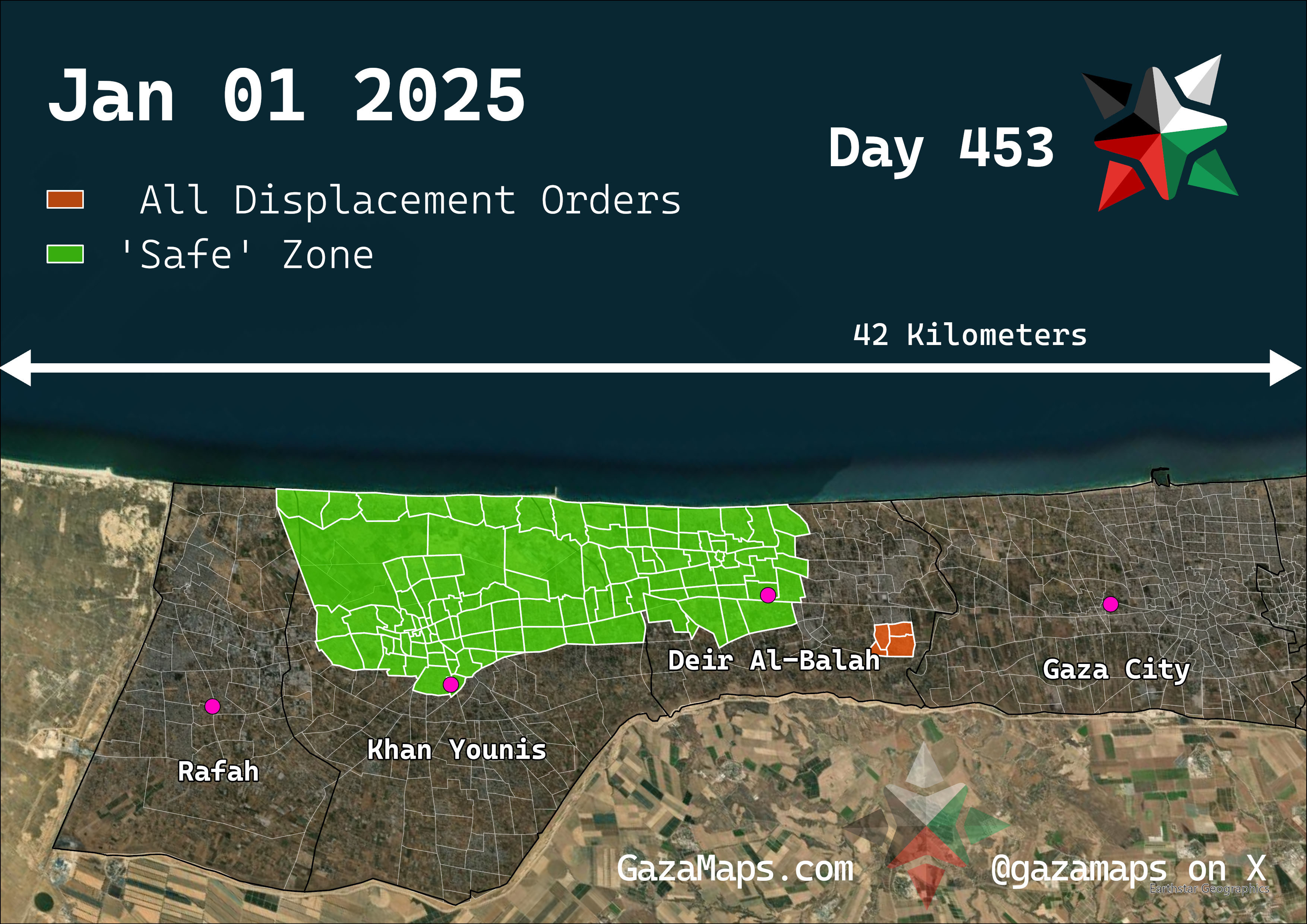
Readable Version, Zoomed In
A zoomed in readable version of the IDF's forced displacement order
IDF Version: 1 Jan 2025